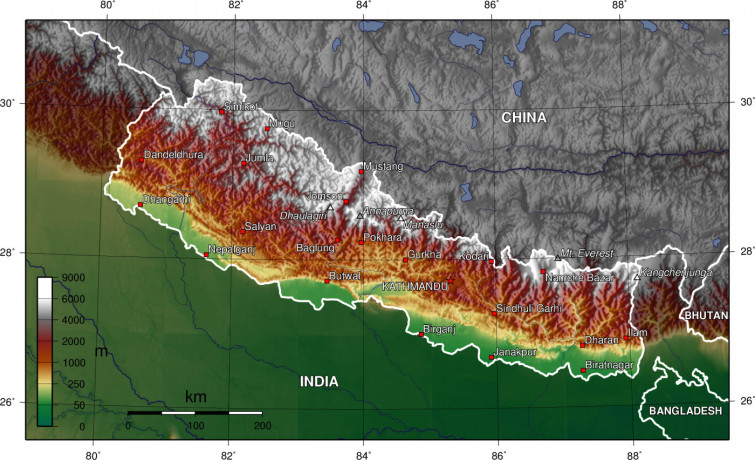
Charting the Soul of Nepal: The Significance of the Nepali Map Professional
Nov 28th, 2023 at 06:05 Blogs Kathmandu 415 views Reference: 1120Location: Kathmandu
Price: Contact us
Introduction: Nepal, nestled between the towering peaks of the Himalayas, is not just a geographical entity but a tapestry of diverse landscapes, cultures, and histories. At the heart of this nation lies the Nepali map, a symbolic representation of unity, identity, and the territorial integrity of a country that takes pride in its rich heritage. The Nepali map is more than lines on paper; it is a reflection of the nation's spirit and the collective aspirations of its people.
Geographical Diversity: The topography of Nepal is as diverse as it is breathtaking. The Nepali map captures this diversity, featuring the soaring heights of the Himalayas in the north, where some of the world's highest peaks, including Mount Everest, proudly stand. As the land descends, the map unfolds a mosaic of hills, valleys, and plains, each region marked by its own unique charm and cultural nuances.
Bordering Neighbors: The Nepali map is bordered by India to the south, east, and west, and by China (Tibet) to the north. The geopolitical significance of these borders shapes Nepal's international relations and trade dynamics. The map serves as a visual representation of the country's strategic position in South Asia, fostering connections with neighboring nations and contributing to regional stability.
Historical Significance: The evolution of the Nepali map is intertwined with the nation's history and the legacy of its people. Over the centuries, the boundaries of Nepal have seen shifts and negotiations, reflecting the geopolitical dynamics of the region. The Gurkha Empire, which laid the foundation for modern Nepal, contributed to shaping the contours of the map, and subsequent treaties have defined the country's borders.
The map stands as a testament to the resilience and sovereignty of the Nepali people, who have navigated through a complex history while preserving their cultural identity.
Cultural and National Symbolism: The Nepali map is not merely a geographical representation; it is a symbol of national unity and pride. The depiction of the country's borders serves as a unifying force, fostering a sense of belonging among the diverse communities that call Nepal home. The map is often displayed in schools, government offices, and public spaces, reinforcing the idea of a shared identity and destiny.
Tourism and Adventure: For those venturing into the heart of Nepal, the map becomes a guide to exploration and adventure. Trekking routes, national parks, and cultural landmarks are etched onto the map, guiding travelers through the diverse landscapes and heritage sites that make Nepal a popular destination for tourists and trekkers alike.
Challenges and Opportunities: While the Nepali map is a source of national pride, it also represents challenges and opportunities. The country faces environmental concerns, such as deforestation and natural disasters, that impact the integrity of its geographical features. However, the map also outlines opportunities for sustainable development, responsible tourism, and conservation efforts to preserve the unique ecosystems that define Nepal.
Conclusion: The Nepali map is more than a visual representation of borders and geography; it is a living testament to the resilience, culture, and aspirations of the Nepali people. As the nation charts its course through the 21st century, the map continues to be a symbol of unity, guiding the way forward and reminding the world of the extraordinary tapestry that is Nepal.


